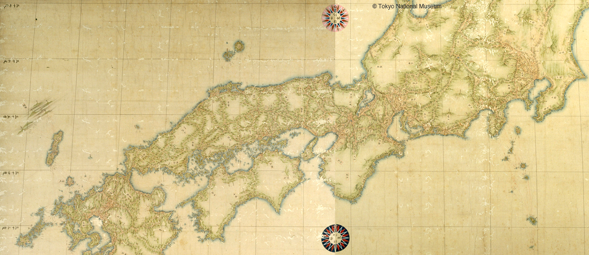
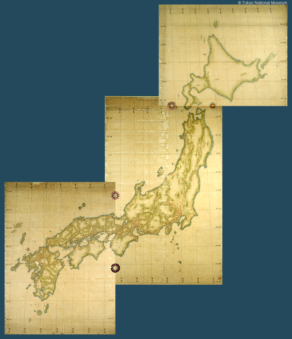


Nihon Enkaiyochizu – the Map of Japan by Ino Tadataka – were made on the basis of surveys performed in the early nineteenth century. Precise and drawn in the manner of beautiful pictures, the maps were depicted in faint greens, blues and other colours and a striking accent and overall unity were provided by red lines which recorded the survey itself. Ino Tadataka travelled the length and breadth of Japan on foot for 17 years from the age of 55 to perform his surveys. The accuracy of his maps also owed much to the fact that he was the first surveyor in Japan to combine measurements on the ground with observations of the heavens. Ino started the work as a private individual but earned the confidence of the Shogunate and it eventually turned into a national project. His maps were later used for many years as the foundation for maps made by modern survey techniques.